

wroSIP mobile app for iPhone and iPad
Developer: GISPartner Sp. z o.o.
First release : 12 Nov 2013
App size: 156.48 Mb
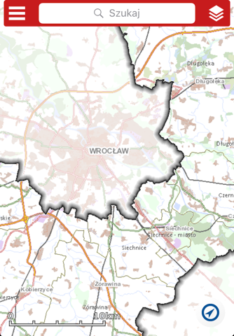
WroSIP mobile application provides the access to data and spatial services of Wrocław County. It is a mobile version of the Internet map service wroSIP. It has been built on the basis of “Agreement for common implementation of Geographic Information System for Wrocław County, wroSIP” signed by County and communes: : Czernica, Długołęka, Jordanów Śląski, Kąty Wrocławskie, Kobierzyce, Mietków, Siechnice, Sobótka and Żórawina.
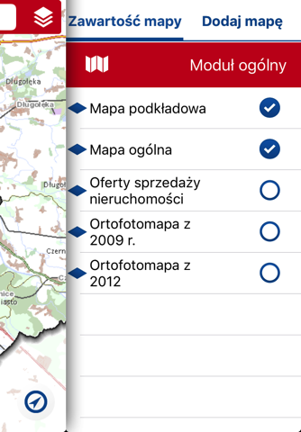
Application provides:
•Managing map modules by enabling thematic data layers grouped into thematic modules and changing layer’s transparency,
•Free navigation within map (pan, zoom in, zoom out),
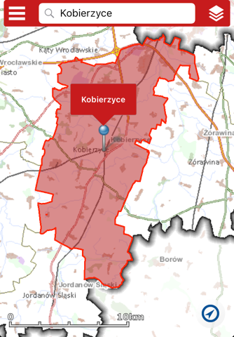
•Navigating and searching for features, i.e. by address, parcel’s number,
•Adding previously defined WMS services
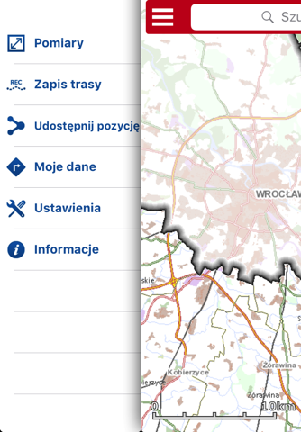
•Tools for measuring distance and area,
•Registering user’s current location with the option of sending a URL address to this location via e-mail,
•Registering route and saving it in KML format
Disclaimer:
Continued use of GPS running in the background can dramatically decrease battery life.